Carn Fadryn Hill Fort
Carn Fadryn Hill Fort


Discover the ancient roots of ‘the castle of the sons of Owain’
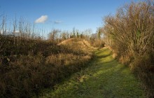
This commanding location in the centre of the Llŷn Peninsula has fortifications upon it that stretch back to the Iron Age. The earliest phase of building dates from around 300 BC, when an area of some 12 acres was enclosed within a banked-earth rampart and ditch. Around 100 BC the fortified area was extended to cover about 26 acres. The final phase of building took place much later, around the 12th century AD, and the result is believed to be the ‘castle of the sons of Owain’ mentioned by Gerald of Wales in 1188. The fortress was built as a symbol of power in the turbulent period that followed Owain Gwynedd’s death in 1170 and the division of the territory between his sons.
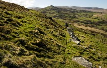
The site reputedly gets its name from Queen/St Madrun (or Modrun) – the granddaughter of Vortigern, the British chieftain blamed for inviting the Saxons to these shores. Even if this is true, the earliest phase of building here predates Vortigern by some 700 years. Little is left beyond a weathered rampart with entrances north and south. The second rampart, dating from 100 BC, is better preserved.
A substantial number of pre-Roman roundhouses were located within the enclosure, and the remains of around 10 of them still survive. There is also evidence of the construction of many irregular houses during the late Roman period, a date which corresponds to the era of Vortigern. A bronze ‘looped palstave’ or axe was found here in 1839; it is now held by the National Museum Wales in Cardiff.
Documents
Cynllun Carn Fadryn Map application/pdf / 0.26 MB- Parking
- Good Walks Nearby
Directions
By Road
From Pwllheli head north on the A497. Turn left onto the B4415. After Rhyd y Clafdy follow signs for Carn Fadryn. Park near chapel.
By Rail
Pwllheli - 8 miles
By Bus
Rhyd y Clafdy bus stop
By Bike
Main road
Access Details
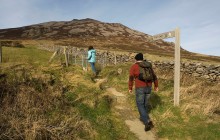
Mountain footpath, 45 minutes uphill. Walking boots required. OS map required.
Practical Details
Full Figure Grid Reference: SH 280352 OS Landranger map sheet: 123
Contact
- Address
- Carn Fadryn Hill Fort, Botwnnog